
ROMANIA
Buzău Land UNESCO Global Geopark
The Geopark disseminates our geo-heritage for you as a guest and to us living here. Welcome!
About the geopark
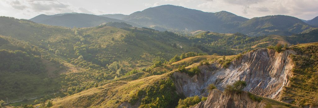
Buzău Land UNESCO Global Geopark is a hilly and mountainous territory covering 1,036 km² and located in the Carpathian Curvature, in Romania. It is a rural and historically rich region, home to approximately 40,000 residents across 18 communes. The villages and hamlets are predominantly clustered in depressions or along valleys, while others are scattered on slopes or high plateaus.
The area spans an altitude range of over 1,200 meters, rising from ~120 meters at its southern border to more than 1,360 meters in the northern part of the territory. The southern portion is defined by large depressions surrounded by rolling hills, whereas the northern area transitions into deeper, narrower valleys and abrupt cliffs as the terrain shifts from hilly to mountainous.
Situated at the junction of three continental plates, the Geopark chronicles the formation of the Carpathian Mountains. It preserves over 40 million years of geological history, illustrating the evolution of the landscape from a deep-sea environment to the hills and mountains seen today.
History
The idea for the Buzău Land Geopark emerged in 2007 as part of a development strategy for a rural area lacking industrial capacity but boasting one of the highest densities of geosites in Romania. These include spectacular features such as mud volcanoes, eternal flames, salt domes, amber deposits, sandstone concretions, and much more. In 2010, the initiative was adopted as a regional strategy by local authorities. In 2013, an interdisciplinary team of specialists was assembled to work on the project’s implementation. In 2020, the territory officially applied for UNESCO Geopark status, which was granted in 2022.
Main attractions
The Amber Hills
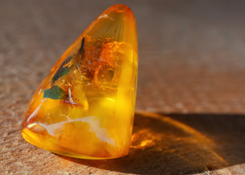
25 million years ago, trees were carried offshore by the waves of a prehistoric sea. These trees slowly sank to the abyssal plain, where they became buried under mud and sand. Over time, the resin attached to their bark petrified, transforming into amber. Earth’s forces fragmented the rocks, and the seabed ultimately rose to form the mountains and hills we see today. In Colți, if you look carefully in the riverbeds, you may even spot some of these colorful semiprecious stones. Among them is the world-unique, pomegranate-red amber, known as rumanite.
The Large Mud Volcanoes
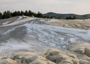
How about climbing the largest mud volcano in Europe? The Large Mud Volcanoes form a “shield volcano,” sprawling across a vast area, with a central main cone surrounded by smaller cones. Constantly active, it sputters mud and generates small explosions (gas bubbles breaking and splashing mud), and produces mudflows. Although the process differs from magmatic volcanism, these eruptions are reminiscent of those in Hawai’i or Stromboli but occur on a far smaller scale.
The Salt Domes and Canyons
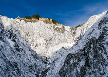
Buzău Land is truly the “Land of Salt.” This white rock, once deposited on the bottom of a prehistoric sea, now gradually rises to the surface, forming hills. The Meledic Salt Plateau is the most popular and accessible salt dome in the area. It features numerous caves adorned with stalactites and crystals, deep valleys carved into white rock, and remarkable sights such as two lakes, a nature reserve, a canyon, castle ruins, and an outdoor wooden sculpture collection. This area is regarded as having the most complex karst landscape in Romania. One salt cave, among the longest in the world, has revealed many fossils dating back to the last ice age.

The Eternal Flames
The Eternal Flames dance atop a hill near the village of Terca and in a deep valley close to Lopătari. These natural phenomena result from gases rising from nearly three kilometers underground and igniting upon reaching the surface. Like a natural stove, these flames have been burning for hundreds of years, embedded in local legends involving dragons or spirits.
The Sandstone Concretions
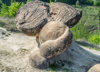
12 million years ago, the area encompassing Bozioru, Odăile, and Cozieni was a prehistoric delta. The sands deposited by rivers back then now form the hills we see today. In recent millennia, some of these sands naturally cemented due to mineralized water infiltration, which deposited a calcium-rich cement. Erosion by wind and rain has since revealed unique shapes, like spheres, cylinders, and spirals, traditionally referred to as “the old men and old ladies,” or sandstone concretions.
The Volcanic Grunj from Mânzălești
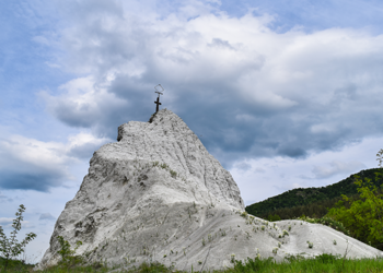
14 million years ago, as the prehistoric seas began receding and the Carpathian Mountains took shape, intense volcanic activity occurred to the north. One eruption filled the sky with ash: microscopic crystals and magmatic glass. Carried by wind over the sea, the ash settled on the seabed and, over millions of years, solidified into rock. A striking remnant of this event, enduring to this day, is a white spur of volcanic ash known locally as the Grunj.
Practical information
How to get here
Buzău Land UNESCO Global Geopark is conveniently situated near two major cities with airports: Bucharest and Brașov. The majority of visitors travel from Bucharest via Otopeni International Airport. From there, the Geopark is located just 130 kilometers away, making it accessible by car in under two hours.